
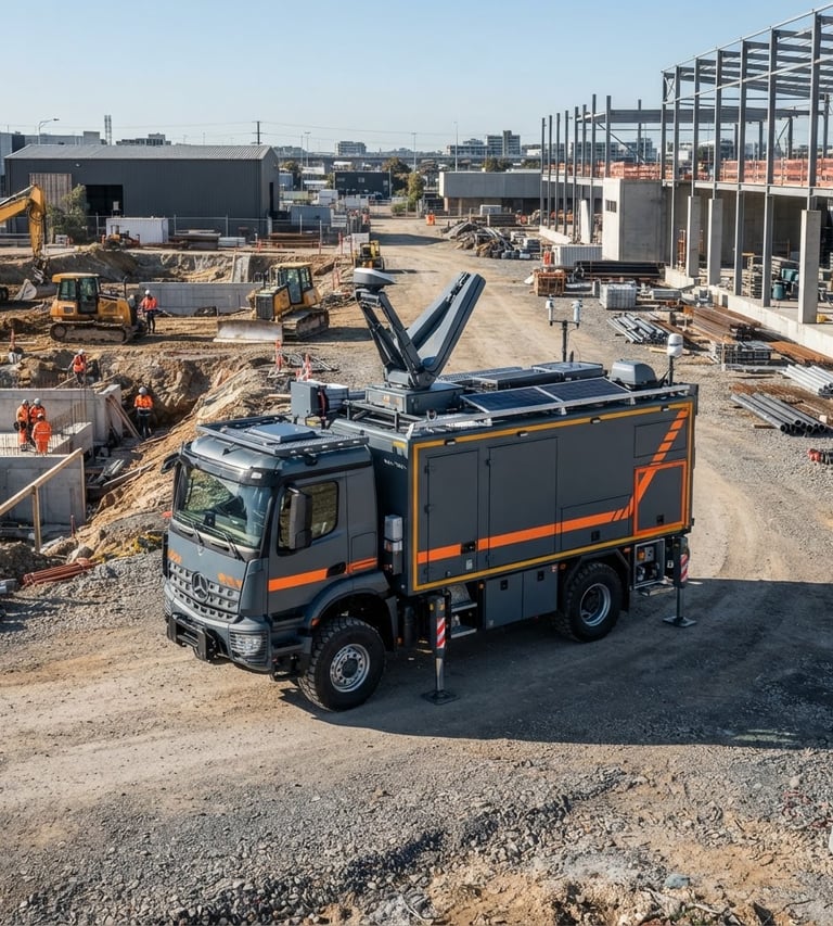
Millimeter-accuracy spatial data verified on-site.
We deploy mobile ground-stations and dual-frequency GNSS telemetry across the Mid-Atlantic corridor, delivering certified field-to-finish datasets directly to civil engineers and developers.
Certified technical precision
1.0mm
GNSS horizontal accuracy
100%
On-site CAD verification
3
Licensed states of operation
Rigorous spatial deliverables
Our field crews combine traditional land surveying rigor with advanced aerial telemetry to eliminate project delays.
Boundary & Civil Surveying
Drone-Assisted Mapping
Infrastructure Inspection
Certified ALTA/NSPS land title surveys, topographic mapping, and construction layout services executed with dual-frequency GNSS.
High-resolution orthomosaics, digital elevation models, and volumetric analysis processed directly inside our mobile ground-stations.
Structural asset condition reports, utility corridor mapping, and high-precision geographic data for municipal planning.
Eliminating geographic uncertainty on-site.
Every coordinate is verified against dual-frequency GNSS baselines, ensuring your civil engineering team works with absolute physical truth.
Coordinate your upcoming survey
Connect with our Rockville office to schedule mobile ground-station deployment and secure certified spatial data for your project.
MIYASHIRO ASSOCIATES L.L.C.
Millimeter-accuracy on-site verification.
Sitemap
Home
About
Services
Contact
Rockville Office
MIYASHIRO ASSOCIATES L.L.C.
254 N WASHINGTON ST, APT 310, ROCKVILLE, MD, 20850, US
Phone: +17034026536
Email: admin@miyashiroassociates.com
© 2026 MIYASHIRO ASSOCIATES L.L.C.-Licensed land surveying and aerial mapping across the Mid-Atlantic corridor.
FIELD-TO-FINISH ACCURACY